High Localization Accuracy
Our LiDAR-based real-time localization system enables
positioning accuracy of +/- 10 cm.
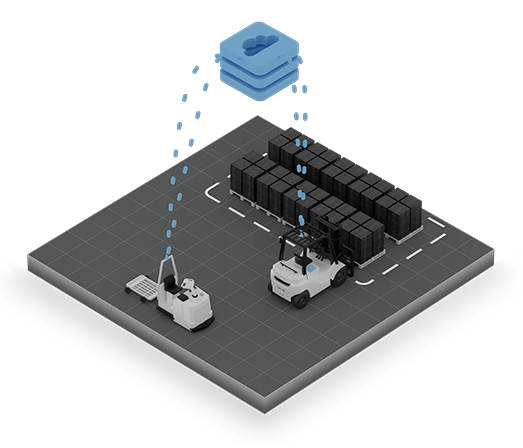
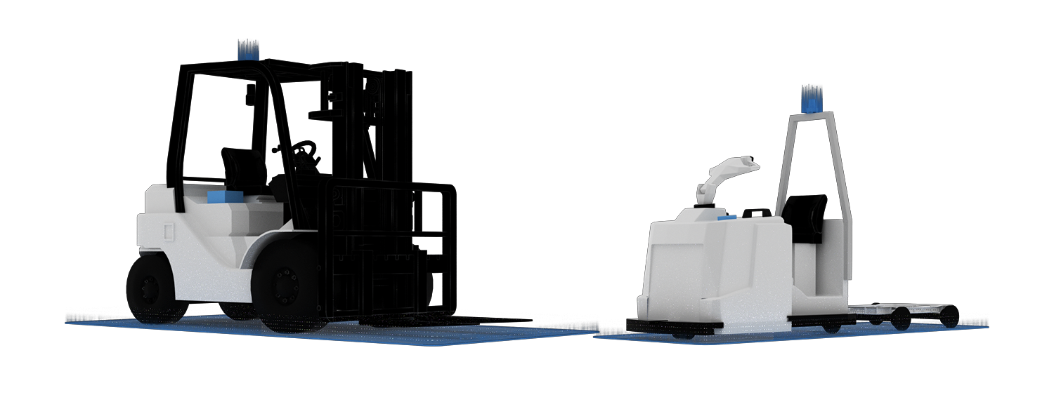
NODE.tracking is a LiDAR-based real-time localization system designed for accurate and flexible tracking of manual vehicles like forklifts and tugger trains, even in rugged environments. It enables marker-free localization with an accuracy of +/- 10 cm and can be seamlessly integrated into mobile robot navigation maps or used as a stand-alone solution.
At its core, NODE.tracking leverages NODE.localize, our industrial-proven localization software stack, ensuring precise positioning in dynamic environments. The system can be mounted on any industrial vehicle, providing continuous tracking capabilities. Even after power interruptions, NODE.tracking autonomously re-localizes, maintaining operational continuity without manual intervention.
By delivering reliable, high-precision localization, NODE.tracking boosts mixed-fleet visibility and lays the foundation for asset tracking. Its robust, adaptable design makes it a valuable solution for industries that demand real-time, cost-effective, and scalable tracking in challenging environments.
Our LiDAR-based real-time localization system enables
positioning accuracy of +/- 10 cm.
RTLS maps can be shared across mobile robots for
faster and more efficient fleet setup.
No additional infrastructure required—precise tracking
without markers in the environment.
Connects directly to your fleet management and
warehouse management systems via VDA 5050.
Conventional tracking solutions depend on physical markers or RFID tags, leading to increased maintenance and deployment complexity. NODE.tracking provides sub-10 cm accuracy using LiDAR-based localization—eliminating the need for external infrastructure and reducing operational overhead.
Fixed tracking infrastructures require costly modifications as operations evolve. NODE.tracking’s software-driven approach enables seamless scalability, allowing businesses to adapt tracking systems without additional hardware investments.
GPS and UWB-based systems often struggle with accuracy indoors or in dynamic settings. NODE.tracking leverages high-precision LiDAR data to ensure consistent, real-time localization, even in rapidly changing production and logistics environments.
Traditional tracking systems involve significant infrastructure investments and ongoing maintenance costs. NODE.tracking eliminates these inefficiencies with a marker-free, low-maintenance design, providing a faster return on investment and sustainable cost reductions.
Legacy tracking solutions often lack interoperability, creating integration challenges with fleet management, warehouse, or automation systems. NODE.tracking is designed for seamless connectivity, supporting industry standards such as VDA 5050, ERP, and WMS to enable fully synchronized and reliable asset tracking across operations.
Download the NODE.tracking one-pager and see how our solution makes reliable RTLS possible in your operations. All essential details are summarized in one place to support a well-founded evaluation.
Leasrn more about out versatile robot autonomy skill designed for localization and mapping in industrial environments. It uses Live SLAM technology to create detailed maps, even in large-scale or complex spaces. During operation, the system continuously updates the map by tracking changes in the environment, ensuring accurate and consistent localization.
NODE.localize